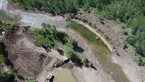
Evanston Dam, Wyoming during restoration efforts. Photo credit: Jason Jaacks.
The Western Native Trout Initiative (WNTI) has launched a new interactive ArcGIS StoryMap showcasing collaborative efforts to reconnect rivers, restore aquatic habitats, and support the recovery of native Bonneville Cutthroat Trout throughout the Bear River watershed.
Titled “Freeing the Bear: One Barrier at a Time,” the StoryMap highlights more than a decade of conservation work focused on removing and modifying fish passage barriers across portions of Utah, Idaho, and Wyoming. Partners such as the Resources Legacy Fund, the US Fish and Wildlife Service, Trout Unlimited, and many others helped fund and complete the work. With over $6 million in funding, partners have removed or improved 24 structures, including dams, diversions, and culverts, and reconnected approximately 145 miles of river habitat for native fish migration and spawning.
The StoryMap combines interactive maps, restoration project profiles, photography, and historical context to demonstrate how collaborative conservation is restoring river connectivity, improving water infrastructure, and supporting local communities.
The National Fish Habitat Partnership also featured the StoryMap. Read the press release here.